Mars’ Grand Canyon
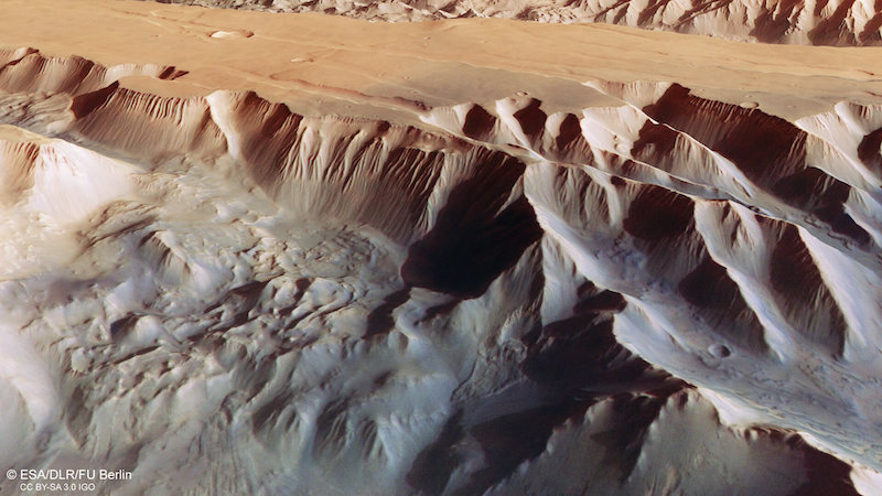
Mars is smaller than Earth (about half Earth’s size). But its vast canyon system called Valles Marineris dwarfs even our earthly Grand Canyon. Orbiting spacecraft have imaged it many times. This month (July 20, 2022), the European Space Agency released some stunning new images from its Mars Express orbiter. The orbiter captured portions of the massive canyon, giving us a closer look than ever before.
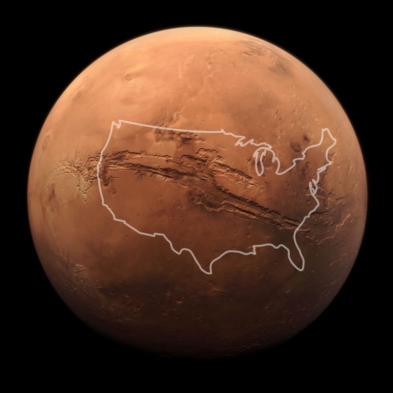
Valles Marineris – the largest canyon system in our entire solar system – is some 10 times longer, 20 times wider and five times deeper than the Grand Canyon.
To put it another way, Valles Marineris is over 2,500 miles (4,000 km) long, 120 miles (200 km) wide and up to 4.3 miles (7 km) deep. Wow!
Long, deep canyons
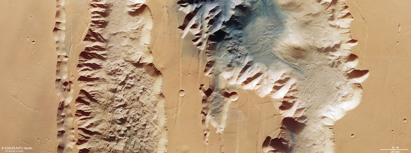
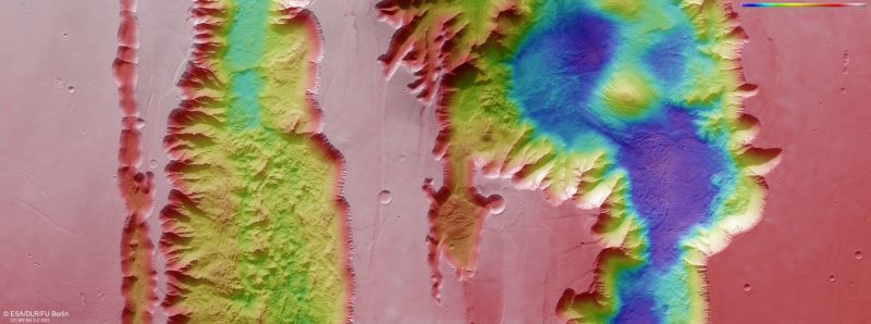
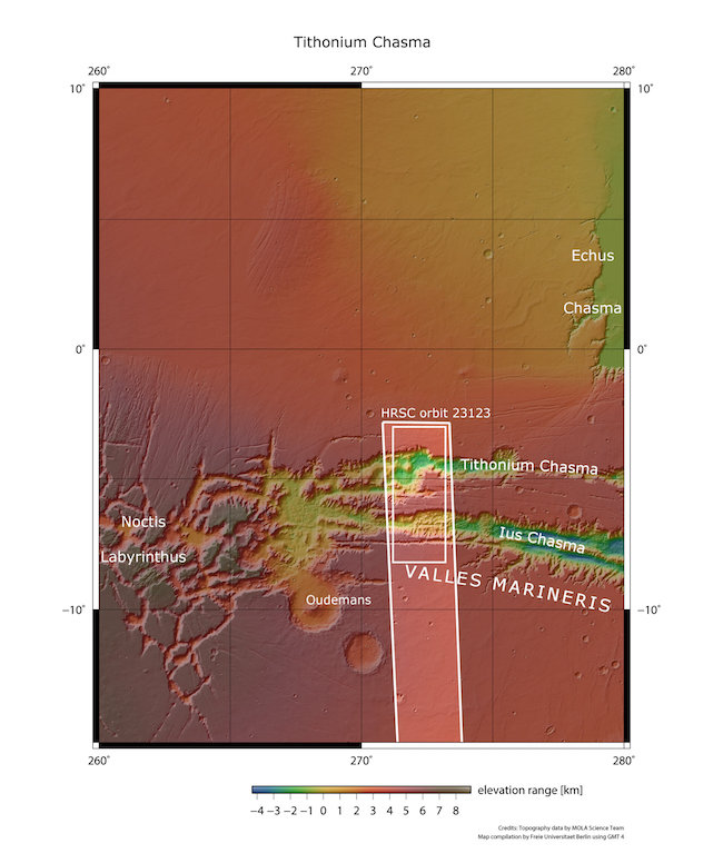
The new images show details inside two trenches or chasms – called chasmata – that are part of the western end of the canyon. The first is Ius Chasma, at 522 miles (840 km) long, and the second is the 500-mile (805-km) long Tithonium Chasma.
These chasmata are some of the deepest parts of Valles Marineris, up to 4.3 miles (7 km)! Imagine the view if you were standing near the edge of one of these chasma and looking across.
Sand dunes, mounds and landslides
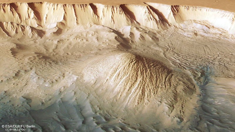
Tithonium Chasma contains distinct dark sand dunes that scientists say may have originated from the nearby Tharsis volcanoes. Two light-toned mounds lie next to the sand dunes. They are like small mountains, rising to about 9,842 feet (3,000 meters) high. Wind has heavily eroded them. This shows that the material they are made of is weaker than the other rock in the canyon.
Intriguingly, there are also some smaller bumps between the mounds. They contain water-bearing sulfate minerals, which point to liquid water being present long ago. Indeed, the water may have once filled the chasma, although scientists are still debating that one.
You can also see landslides in the new images. Scientists think some of them occurred fairly recently, since the material has not had much erosion yet.
Meanwhile, in Ius Chasma, there are jagged triangles of rock on the canyon floor that look like shark’s teeth.
Mars’ Grand Canyon and Earth’s Grand Canyon
Besides just scale, Valles Marineris and the Grand Canyon differ in other ways as well. Flowing water from the mighty Colorado River formed the Grand Canyon, as the water gradually eroded away rocks over eons. Scientists think Valles Marineris, however, is a huge tectonic crack in the surface. As Mars slowly cooled after first forming, the crust rose in the Tharsis region to the west. It cracked and split as a result. Subsequent erosion continued to widen and deepen the crack into the canyon system we see today.
There are, however, some outflow channels in the eastern portion of Valles Marineris that appear to have been formed by water. And indeed, there may still be some water left today, below the surface. Last December, scientists reported that the joint European-Russian Trace Gas Orbiter (TGO) found evidence of water below ground in Valles Marineris. It is most likely in the form of ice.
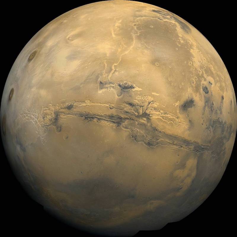
Bottom line: ESA’s Mars Express orbiter has taken some stunning new images of Mars’ Grand Canyon, Valles Marineris. It is the largest canyon system in the solar system.
The post See Mars’ Grand Canyon in stunning new photos first appeared on EarthSky.
0 Commentaires