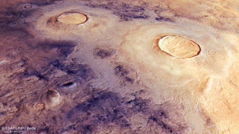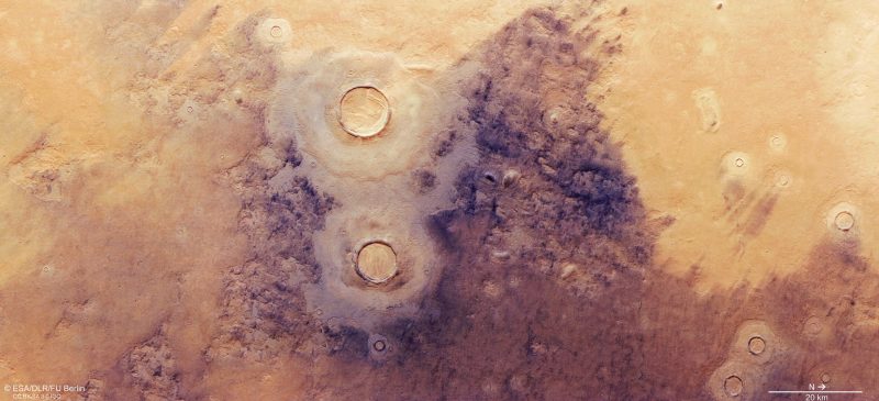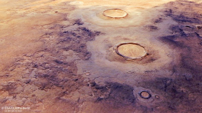
ESA released new images on March 30, 2022, featuring the largest known impact basin in the solar system. It’s called Utopia Planitia (“Nowhere Land Plain”). And it is a large, relatively flat plain on Mars (estimated diameter of about 2,000 miles or 3,300 km). The Viking 2 lander – 2nd craft ever to soft land successfully on Mars – touched down and began exploring within Utopia Planitia in September, 1976. The new images are from ESA’s Mars Express spacecraft. They zero in on a section of the Martian plain, which is in Mars’ northern hemisphere. Double-layered mounds of material surround the two largest impact craters and their thick rims, along with dust-filled icy fractures. You can see brain terrain, a deformed and warped pattern that resembles the surface of the human brain, inside the 2nd-largest crater.
Textures on Mars surface
Scientists think this Martian plain formed as a mix of sediments, lavas and volatile substances filled the Utopia basin. Water, wind and other processes would have transported these materials across the red planet’s surface.
This ice-rich region has smooth patches known as mantled deposits. When Mars’ rotational axis was much more tilted than it is today – at least some 10 million years ago – snow formed these thick layers of ice.
Look closely inside the 2nd-largest crater to see the brain terrain. This texture is most common in a region that sharply separates the northern and southern hemispheres. The Martian dichotomy, as scientists call this region, separates northern lowlands from southern highlands.
The dark colored areas are icy ground that has fractured at low temperatures. Dust blown on the wind lodges in the polygonal patterns.
Scientists think the scalloped depressions are from ground ice melting or turning to gas. This causes the surface to weaken and collapse.


Bottom line: ESA shared some new images of the Mars surface from its Mars Express spacecraft. They show craters, brain terrain, layered deposits and more.
Read more: Are organic salts on Mars a clue to life?
The post Mars surface layers and ‘brain terrain’ first appeared on EarthSky.
0 Commentaires